The SDS2DDF is a VB 6 application that creates an ascii file that can be imported into Trimbles Data Dictionary Editor, and then into their GeoExplorer (and other) GPS receivers for field collection.

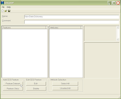
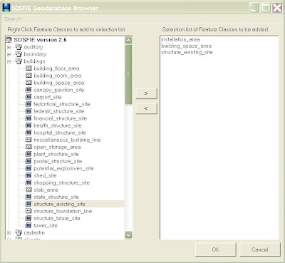
The above graphic shows the SDS2DDF as soon as it has been opened. Users can select to navigate through SDSFIE Feature Classes either by class, or grouped by Feature Dataset. The browser below shows the browse by Feature Dataset option. Users can also conduct a search by keyword to find a Feature Class that best meets there needs.

The user above has selected three Feature Classes. After selecting OK, the Feature Classes are loaded into the Main application screen (below).
Users can then browse through all of the loaded attributes for each Feature Class and determine which ones they would like to export to the final data dictionary. They can also view the description and domain values (if present) for each attribute field.
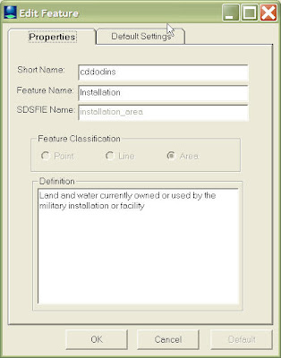
Users can also change certian properties for each feature, such as the alias name to be used (below).

Users can also change certain aspects on how the data is collected by the GPS receiver.


