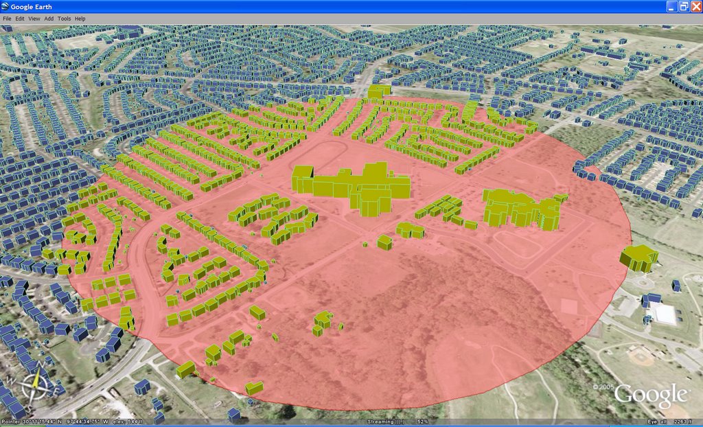
 The image (show above) of Keyhole Markup Language (KML) data in Google Earth was created entirely with shapefiles and GIS software that is freely available over the Internet. OpenJUMP was used to create the buffer around a school. MapWindow GIS was used to apply the symbology. Shape2Earth (which works as a plug-in for MapWindow) was used to convert the shapefile to KML, which was then loaded in Google Earth for visualization.
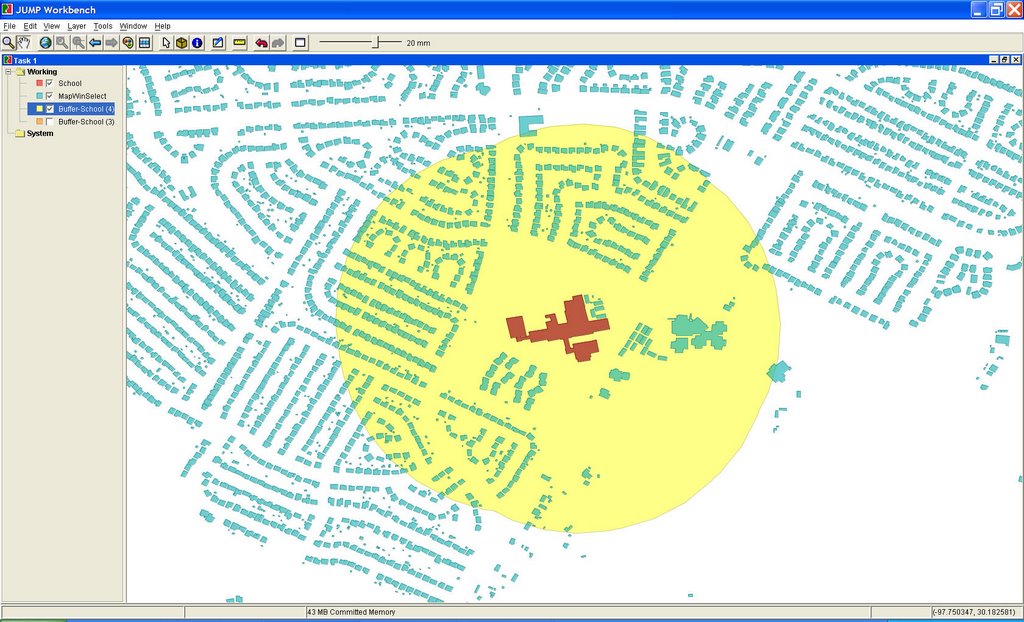 Above: OpenJUMP (open source GIS written in Java) is used to create a buffer around the selected building.
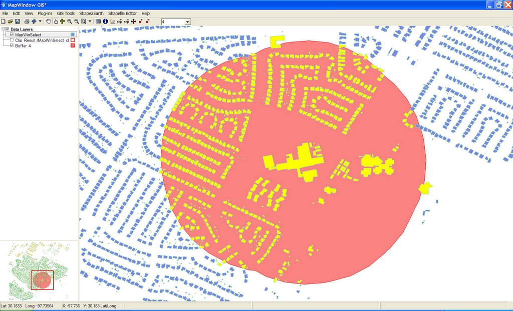 Above: The buildings and buffer shapefile are loaded into MapWindow GIS (open source GIS written in .NET). Symbology is applied, and Shape2Earth is used to convert the shapefile and symbology into KML.
Now that Shape2Earth is in beta testing, I have had the opportunity to get some great feedback on its functionality, and have seen some REALLY cool KMLs created by a number of people througout the world.
good!!
ReplyDeleteamazing :)
ReplyDelete