As an example, if you are going to be making decisions based on a spatial dataset, you need to know how accurate and/or precise the data is. Data may have been collected using high grade survey equipment, or it may have been digitized from the educated guess of a subject matter export. Both of these data may be useful, as long as the user knows about these accuracy issues.
ESRI provides two different metadata editors in ArcCatalog. One uses the FGDC metadata profile, and the other an ISO profile (both have some extra ESRI elements added).
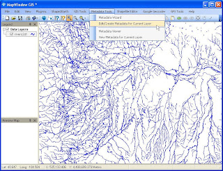
The new release of MapWindow GIS (a freely available, open source GIS) has an excellent metadata extension that provides a number of metadata creation, management, and visualization tools.
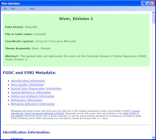
The Editor can be launched from MapWindow, and can show metadata from a loaded shapefile, or from a metadata xml file loaded from the user interface. Metadata can also be viewed using a number of built in styles sheets.
The metadata editor seems to work very nicely. One change I would like to see would be the ability to store user contact information so that newly created metadata could be updated more easily.
 The Metadata Editor can be launched from MapWindow
 A simple to use TreeView lets users navigate through metadata elements
I would like to see a change so that users can save contact profiles for quick loading.
Of course this is open source, so there is nothing stopping me!
 Metadata can be quickly viewed using a number of built in style-sheets.
