[Note: Shape2Earth is now available for
Download]
Last week I wrote about the work I was doing with open source GIS to create a shapefile to KML converter that took advantage of the editing and symbolism that was offered through MapWindow GIS (
Shapefile to KML using Open Source GIS). I thought I would follow up with a couple of other interesting things you can do with this application. In particular, I thought I would show some ways that you can explore GIS attribute data using the reload capability.
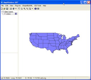
I'll start off with a shapefile of the USA that I downloaded off of the internet.
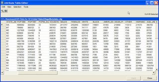
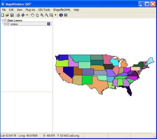
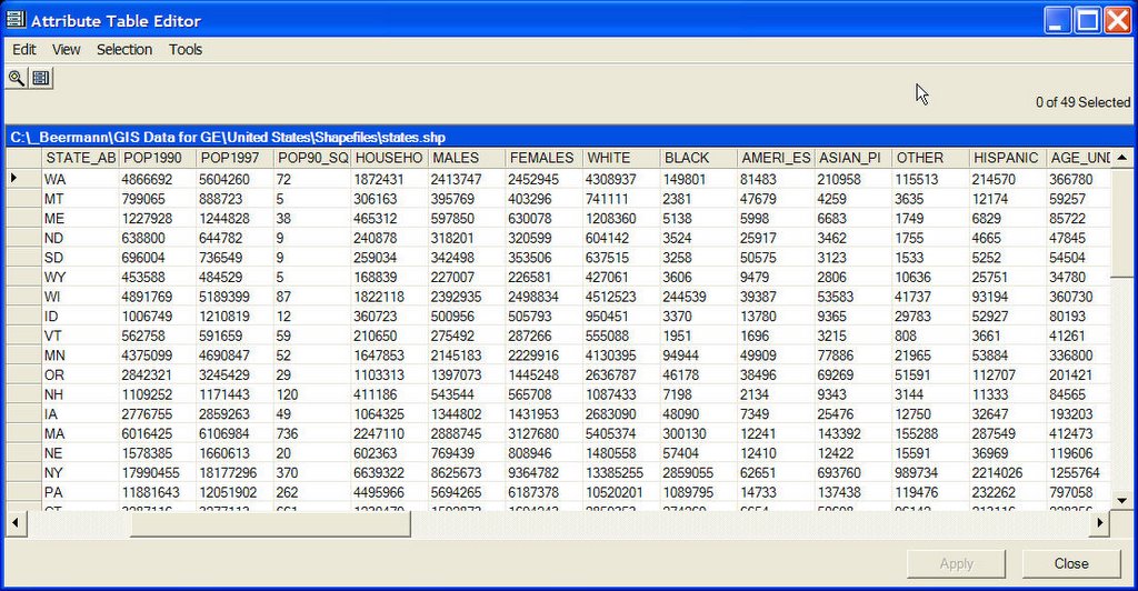
This shapefile has a lot of attribute data associated with it. Opening the attribute table (below) shows all of the different data that is available for each state.
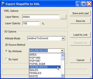
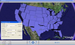
 After I have explored the different attribute data that I can use for my map, I open the Export Shapefile to KML application within MapWindow GIS. I am going to use some of the attribute information to act as the height for each of the state features. This will, in effect, turn my map of the USA in Google Earth into a chart. Below, I have selected HOUSEHOLDS as the value I am going to use as my height source
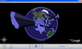
Once I have done this, I will select the Load As Link button on my form. As you may recall from my previous description of this application, this button creates a Google Earth Network Link that references the data KML that represents the actual map data. This will allow me to reload the data again after I have made any changes. Below is the result of this KML conversion.
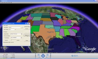
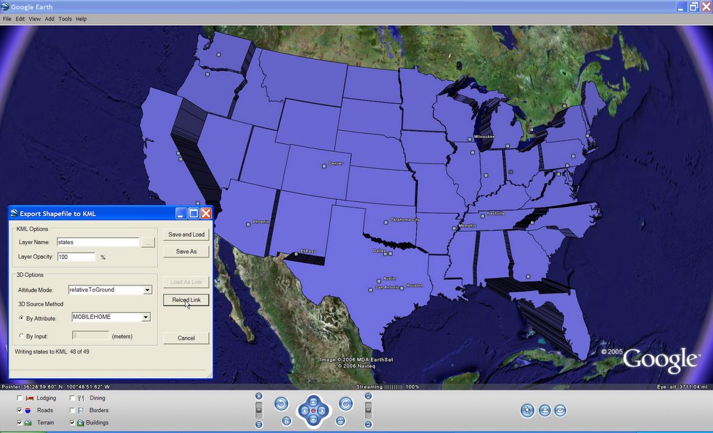
 Next, I decide that I want to see the states listed by number of mobile homes. All I have to do is bring back up the Export Shapefile to KML form, select MOBILEHOME as the height attribute, and click on the Reload Link button. This will rewrite the KML and reload it into Google Earth automatically (see below).
 I can also use the attributes the modify the color scheme using MapWindow GIS. Below, I have given each state a unique color value.
 I can then go back to my Export Shapefile to KML form and hit Reload Link. Below, I have selected NO_FARMS87 as my height value before reloading the KML into Google Earth.
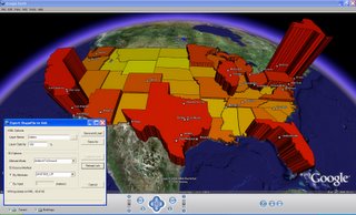
 Finally, I can put it all together. Before making the map below, I set the colors in MapWindow GIS to be a continuous ramp from red to yellow using UNITS50_UP as the attribute value. I then used the same attribute field for my height.
These are just some simple examples of being able to modify and load shapefiles into Google Earth using open source GIS and my shapefile to KML conversion tool.
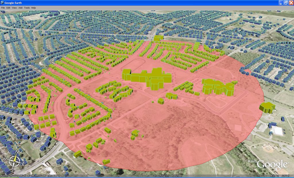 The image (show above) of Keyhole Markup Language (KML) data in Google Earth was created entirely with shapefiles and GIS software that is freely available over the Internet. OpenJUMP was used to create the buffer around a school. MapWindow GIS was used to apply the symbology. Shape2Earth (which works as a plug-in for MapWindow) was used to convert the shapefile to KML, which was then loaded in Google Earth for visualization.
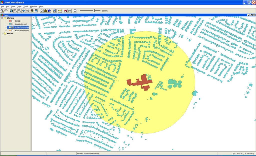 Above: OpenJUMP (open source GIS written in Java) is used to create a buffer around the selected building.
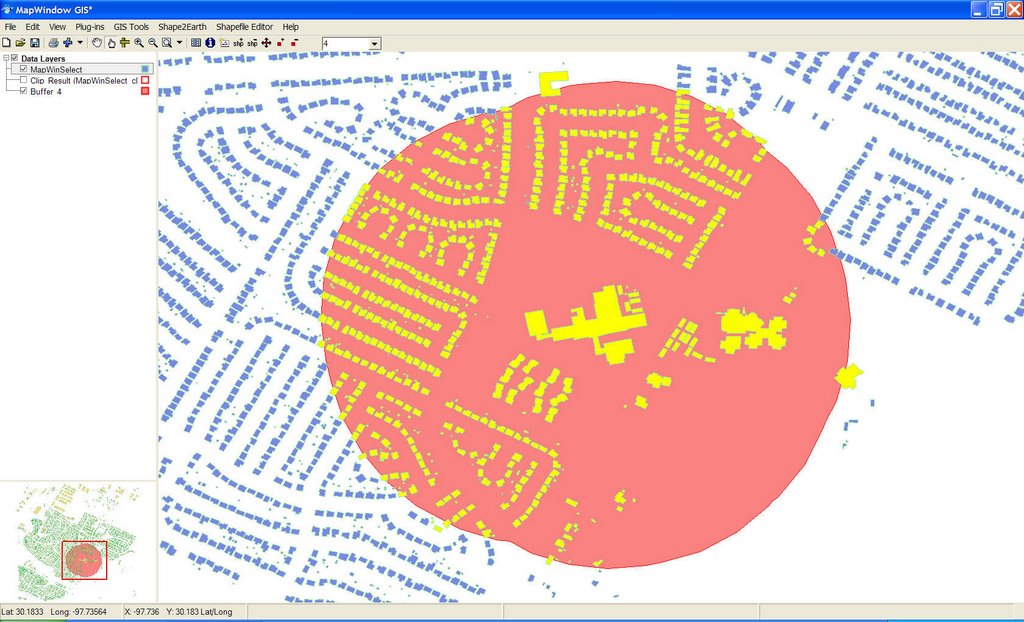 Above: The buildings and buffer shapefile are loaded into MapWindow GIS (open source GIS written in .NET). Symbology is applied, and Shape2Earth is used to convert the shapefile and symbology into KML.

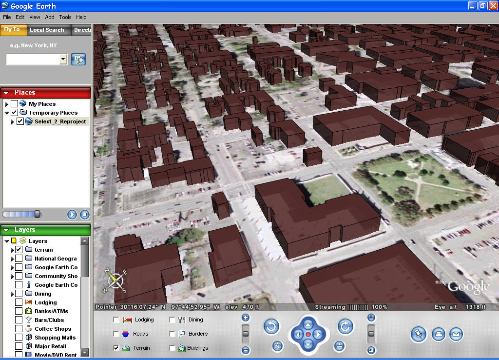
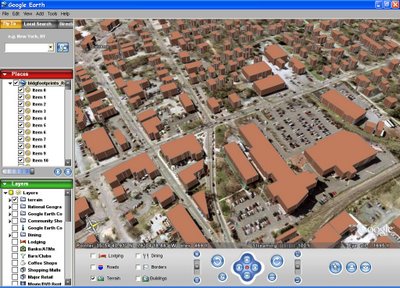 Building footprints, Carrboro, North Carolina.
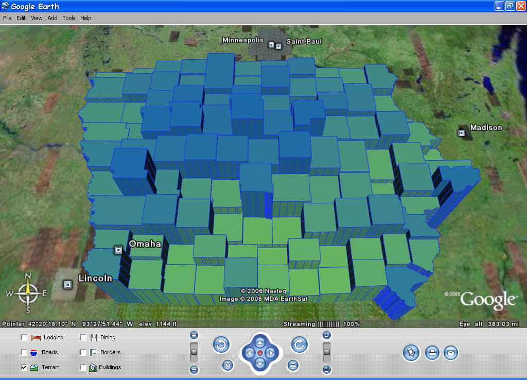


