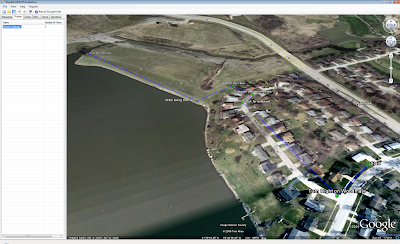
I have been working on a Google Earth based application that uses their new Plugin in a .NET Form called Shape2Earth4GPS. It is an experiment on being able to edit spatial data (in this case, GPS data) directly on the Globe.
Currently, it works very well for digitizing your waypoints and routes, and then saving them as GPX files to upload into your favorite GPS receiver. You can also load and edit your existing waypoints, routes, and tracks.
If anyone would like to act as a beta tester for Shape2Earth4GPS, please send me a note at sabin21@gmail.com
is there a tool for drawing horizontals?
ReplyDelete